Epic ride down there Jamie! And an epic day at the velodrome too by the sounds of it. Great that you can get some cycling in during your time off work too.
You two are certainly putting me to shame... I've hardly been out more than once or twice a week and even then only for <30 miles at a time. Probably doesn't help that I've "taken on" (i.e. been left with) a second more-or-less full time job mind you! Never been on a track bike in my life, but that Johnny Kay looks lovely...
On my Surly LHT
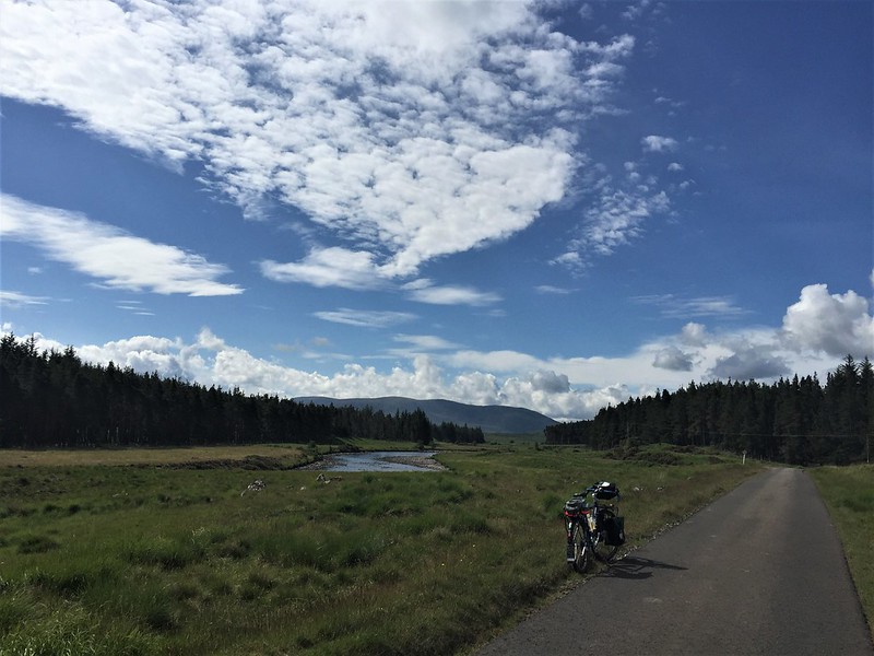
Left Caithness Tuesday and got an early lift towards Bettyhill with Heather and Caleb as to head down to Perth for Wednesday night and then join Vic Polanski from the Flying Scot group along with several others on Thursday morning at the velodrome in Dundee. Had to be in Perth for Wednesday evening so plan was where ever I was on Wednesday around lunch when Heather and Caleb were heading down the A9 then they would swing by and pick me up.
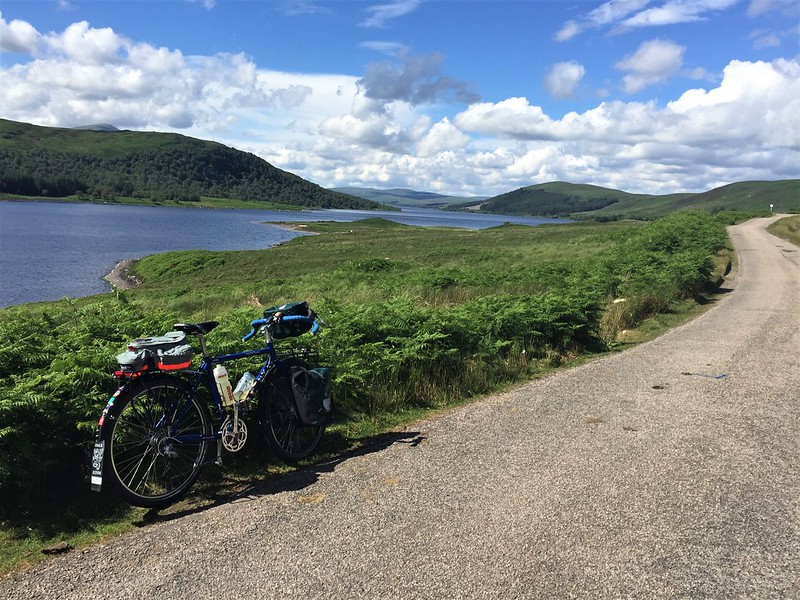
From Thurso it was car and bike to Bettyhill then south to Altnaharra, while it was sunny, it was the mother of all headwind and making any forward progress was difficult. It eased before Altnaharra and while easier it soon returned once out the valley and over the top on the way to Lairg, where I met up with Brian just to the north of, where we stopped for lunch at the lovely Pier Cafe. Sun was out and wind was calmer but still present.Great ride with Brian with a few stops along the way for sure. Sun was out and riding was good but could see it getting blacker as we went on. The tops of the mountains were covered in cloud and as soon as we climbed the Struie we were in a real pea soup fog. Time to stop, lights on, jackets on.
Long day with lots of climbing and a few detours as we ride these roads often, just not usually in a oner. Both were up near 100 miles I think. Lovely evening with Brian and family and a great way to end the day.
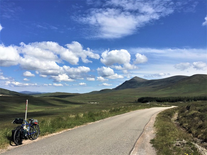
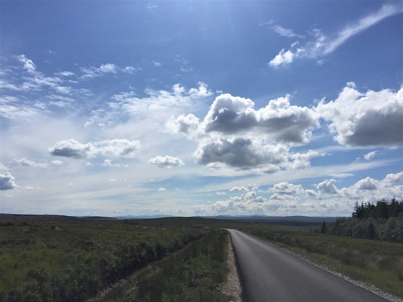
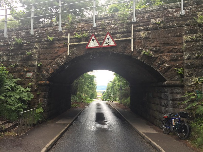
The nest morning was pretty overcast and cold looking, what a difference. Brian decided to ride with me into Inverness where we would have a second breakfast. The first one was good and sorted me to ride though wasn't sure how my legs would go today. We climbed up out of Dingwall and both were surprised with how the legs were working. We soon crested the section of climbs just before the Kessock bridge in a steady rain with the view south and south east looking very cloudy and rainy. We decided to stop at Harry Gows for breakfast just before the bridge as there was no point in Brian riding over the bridge in the rain just to ride back again, especially without any rain gear. So we sheltered from the rain and at bacon rolls and a coffee while hoping it would stop. Soon we parted ways as I was now a long way behind time wise and I had to get through Inverness. Plan was follow Cyle route 1 and 7 until they parted ways just south of Inverness and the follow 7 as far south as I had time. Getting through Inverness was a pain as the footpath of the bridge was closed and so had to cross four lanes of traffic to get to the other side before getting across. made it through no problems and while I deviated on known roads so was far quicker the route out of Inverness takes you so far east before a huge climb out it is such an extra amount of miles and time. Once out and down into the next valley past Clava Stones and the viaduct where the two paths separate the weather was much brighter and the road drier. So nasty short climbs weren't helping the thighs that's for sure.
Eventually made it south of Daviot and just about to Tomatin when Heather was waiting. Such a nice couple of days riding even though some of it was hard going, still lovely. while I was looking forward to seeing family in Perth and also riding again the next day at the velodrome I was still sad it was over.
The next day seen me cycling round the velodrome with Vic Polanski, Vic Posse and Gwyneth Rixon among others as well. Quite cool company with many national and world titles between them. It was a magic couple of hours riding and went in the blink of an eye. I can't have done too bad, despite not being on a track since back in Oz, as I was invited back. hopefully will get back down next month.
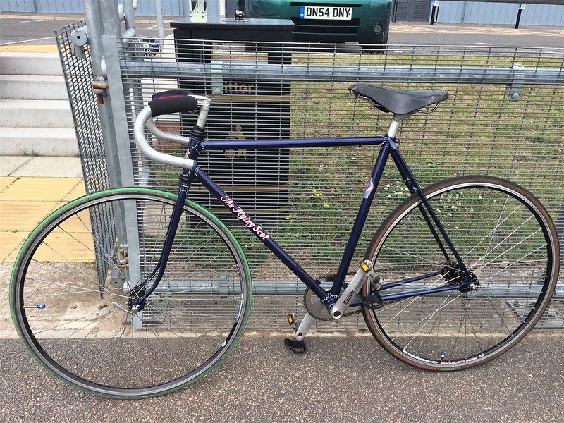
I was also very lucky as the Vic knew I was riding down so said he would lend me a bike and set it up for me so just needed my shoes and pedals. What a bike he setup for me! A 1958 Johnny Kay built for the 1958 Commonwealth games in Cardiff. Such a beautifully built frame. It was truly lovely to ride, with large flange Harden hubs it was so fast and so stable, Vic had even got the gearing spot on for my inexperienced legs. It fit like a glove and made my reacquaintance with the track so much easier.
Then it was back to Perth to continue a few days away with the family. A great week off work.
Just thought I would share.
Hi all
Hope everyone's had a lovely weekend and hopefully the weather was nice were you are. Was a bit hit and miss up here.
Here is a couple of photos of last Sunday when it was till summer and very warm here. Caleb wanted to go for a ride and because it was hot he also wanted to go to the beach and take the surf kayak along. We got the Big Dummy and took the platform off the sidecar, cut and shut a couple of ancient roof bars we had and we were good to go! Well, I say good to go.... It's all off road to our beach and a good section of very deep two tyre tracks type track and then a very rocky section down to the shore. It was fun, if not comedy, but we got there laughing not crying, and that's the main thing
Dummy is usually much more agile on the tracks now that I had taken off the Fat tyres and had the 2.5 ET's on. Handled ............ adequately.
Well this weekend was busy with a few other chores and the weather didn't want to play nicely when I did have a bit of time but regardless I did get a bit of riding and a good amount of tinkering done.
Managed to finally get round to swapping out the handlebars on the Flying Scot tandem and eventually sorting the gears out properly. Ended up pulling quite a bit of it apart on Saturday evening , starting with the bars and levers before taking the brakes apart as well as the shifters, which was a nightmare as one of the bar ends was threaded. Just wanted to give the frame itself a proper degrease and clean, something it really needed before fresh grease all round and start swapping the bits out. Ended up changing the bars for a new set of Nitto B36 Randonneur bars, Tektro levers with new inner and outer cables, new gear cables and sort the front mech out as it has never worked right since we had it. Rack is off to get at the back to clean but also made it easier with the brakes etc. Ended up ditching the old silver mud guards and fitting a set of lightly used red Bluemel Popular guards I had in the loft. Suite it I think. Though front is a bit shorter than the others. So with new bar tape the front is all new and feeling nicer than the mismatch that was on there.
Of course I had to go for a decent ride to make sure it all worked of course. Though it did feel weird riding the tandem on my own.
The rack will go back on tomorrow night as I have Thursday and Friday off work and hopefully Caleb and I will get across to Orkney for a day or two. So needed to have it all set for him and me too of course. Just small changes but felt much better.
That looks amazing. Love the colour scheme.
All those small changes are what make the bike yours rather than just a bike you bought. Can take ages and look not a lot different but make it just right. Well worth the time spent.
Enjoy your trip. Never done a ride involving a ferry, think I’ll need to add that to “The List”.
Just back from a week in Madeira, took the Orange Five over with me as most of the guided rides over there seemed like all day affairs and it didn't seem fair to bugger off and leave Mrs Jimo all day , plus with bike hire cost, it just made sense to take a bike to ride as and when I got the time, and it was surprisingly easy to get a bike there and back.
I soon found out how hilly Madeira is on a quick ride to the local shop, and in the heat it near killed me
I can see why most of the guided tours include uplifts.
The first ride from our villa was a 2 hour slog uphill all the way to the start of a trail, some of the roads were ridiculously steep, even with the 42T out back I was pushing up some stretches and stopping to rest every 100meters in the morning heat.
The trail itself was very dusty and twisted and turned through the forests, it was marked as a Blue trail on Trailforks but I've seen tamer Red routes over here!
The ride back was altogether more refreshing though, a pure downhill speed fest .
2nd ride I started earlier in the morning and went the same route up but did a Red route, unfortunately I forgot to take the charger for my Garmin watch, so as its not on Strava it never happened!
I would take a bike abroad on holiday again, but on a family holiday riding time is limited.
Next time I'd do something with a guide and uplift to make best use of the time I had.
Ye should see the rest, fingers in front of camera, me swearing on a video because I've taken a video not the photie I meant to take etc.....
Educate me as to what I'm doing wrong on Whazzapp...me no know


")


 .
.


![20210803_174112[1].jpg](https://www.retrobike.co.uk/data/attachments/401/401327-07739a35896d9f9272318c6dcb2da74e.jpg?hash=DY5t4lWDlx "20210803_174112[1].jpg")
![20210803_174322[1].webp](https://www.retrobike.co.uk/data/attachments/401/401329-7f10eea9c711f4663b96ff7188eddc01.jpg?hash=4ADkSIDu1b "20210803_174322[1].webp")
![20210803_174326[1].webp](https://www.retrobike.co.uk/data/attachments/401/401331-24d8eb9636c38469e4927479647f594d.jpg?hash=Tm8CTCk5Go "20210803_174326[1].webp")
![20210803_174330[1].webp](https://www.retrobike.co.uk/data/attachments/401/401332-6e2c1573ecbdd96f90a51bce09788896.jpg?hash=Si-ETG4mHa "20210803_174330[1].webp")