You are using an out of date browser. It may not display this or other websites correctly.
You should upgrade or use an alternative browser.
You should upgrade or use an alternative browser.
Show us what you did today, thread
- Thread starter clockworkgazz
- Start date
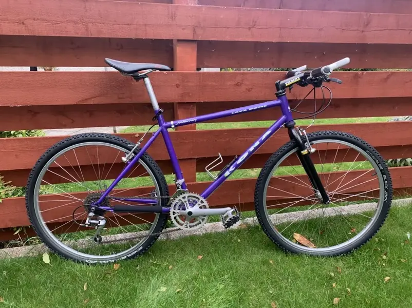
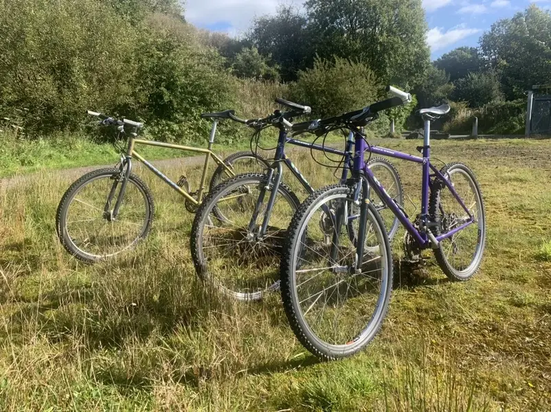
Plenty of scruffy patina on my bikes though not on the freshly painted Mercian.
Plenty of wax just makes them look better in the photos. That JT came out of a chicken shed all rusty and corroded.


Considering this is how it started out and I haven't repainted it, there is still patina if you look closely
 DSC_1661 by Jamie Dyer, on Flickr
 DSC_1659 by Jamie Dyer, on Flickr
 DSC_1670 by Jamie Dyer, on Flickr
 IMG_2777 by Jamie Dyer, on Flickr
Mercian KOM
 DSC_1412 by Jamie Dyer, on Flickr
Because it's worth it
 IMG_3930 by Jamie Dyer, on Flickr
Jamie
Plenty of wax just makes them look better in the photos. That JT came out of a chicken shed all rusty and corroded.
Considering this is how it started out and I haven't repainted it, there is still patina if you look closely
 DSC_1661 by Jamie Dyer, on Flickr
 DSC_1659 by Jamie Dyer, on Flickr
 DSC_1670 by Jamie Dyer, on Flickr
 IMG_2777 by Jamie Dyer, on Flickr
Mercian KOM
 DSC_1412 by Jamie Dyer, on Flickr
Because it's worth it
 IMG_3930 by Jamie Dyer, on Flickr
Jamie
Re:
That Merican frame looks fantastic! I really like the green. I always seem to like green bikes but have never owned one. Might need to address that soon. Looks like the perfect day for the canoe, not a cloud in sight! Your pics are always top notch Jamie. I struggle just to get mine the right way up!
That Merican frame looks fantastic! I really like the green. I always seem to like green bikes but have never owned one. Might need to address that soon. Looks like the perfect day for the canoe, not a cloud in sight! Your pics are always top notch Jamie. I struggle just to get mine the right way up!
Brians Big Bicycle Bonanza of a ride to celebrate his 75th Birthday!!!!!!
'Come on a road ride ' he said
Or ' What could have been if Covid had of allowed'
I am not long in from this great ride with a great friend and sadly due to restrictions it was Brian and myself only, and even for that I am grateful as the plan was originally for a ride up the Bealach with others, though with new restrictions in place we couldn't share the van, not to worry we made the best of what we had and I must say we had a great ride out today covering some old tracks and byroads we know well and finding a few new trails to explore as well.
I drove down south early this morning to park outside Brians, get ready in the van and then we were off. It was quite cool I must say and it was obvious that summer has gone and we are back to the cool but nice autumnal weather. There was a bit of cloud about here and there but minimal wind.
We headed out towards Muir of Ord on a very meandering loop before heading into the hills on the dirt roads to eventually loop back in from the west to Marybank, before heading to Strathpeffer for a coffee and apple pie and hot custard to warm us for the final leg back to Brians.
We did about around 50klms on singletrack roads, dirt roads and also some singletrack back from Strathpeffer so a great mix of roads taking us through some beautiful varied scenery, from high hills to rolling farmland and trails through multi coloured woods, we also seen quite a bit of wildlife from many Red Kites, Squirrel, buzzards and even a sad Pine Marten hit on the side of the road.
Brian was on his ever trusty blue Pompino and myself on my trusty Jack Taylor Super Clubman.
A great casual ride in a relaxed manner just enjoying being out riding on roads we always enjoy at this time of year, by nature though it is a very different ride from just the two of us, and restrictions etc at our usual cafes but at the same time it felt good to do what we so often used to do, so maybe this is the new normal, we will see. Either way to ride where I can ride and the company I can ride with, I am thankful for that.
To my pal Brian, again, wishing you a very Happy 75th Birthday!
 IMG_3965 by Jamie Dyer, on Flickr
 IMG_3970 by Jamie Dyer, on Flickr
 IMG_3972 by Jamie Dyer, on Flickr
 IMG_3976 by Jamie Dyer, on Flickr
 IMG_3984 by Jamie Dyer, on Flickr
 IMG_3993 by Jamie Dyer, on Flickr
 IMG_4005 by Jamie Dyer, on Flickr
 IMG_4007 by Jamie Dyer, on Flickr
 IMG_4012 by Jamie Dyer, on Flickr
 IMG_4020 by Jamie Dyer, on Flickr
 IMG_4022 by Jamie Dyer, on Flickr
 IMG_4029 by Jamie Dyer, on Flickr
 IMG_4033 by Jamie Dyer, on Flickr
 IMG_4035 by Jamie Dyer, on Flickr
'Come on a road ride ' he said
Or ' What could have been if Covid had of allowed'
I am not long in from this great ride with a great friend and sadly due to restrictions it was Brian and myself only, and even for that I am grateful as the plan was originally for a ride up the Bealach with others, though with new restrictions in place we couldn't share the van, not to worry we made the best of what we had and I must say we had a great ride out today covering some old tracks and byroads we know well and finding a few new trails to explore as well.
I drove down south early this morning to park outside Brians, get ready in the van and then we were off. It was quite cool I must say and it was obvious that summer has gone and we are back to the cool but nice autumnal weather. There was a bit of cloud about here and there but minimal wind.
We headed out towards Muir of Ord on a very meandering loop before heading into the hills on the dirt roads to eventually loop back in from the west to Marybank, before heading to Strathpeffer for a coffee and apple pie and hot custard to warm us for the final leg back to Brians.
We did about around 50klms on singletrack roads, dirt roads and also some singletrack back from Strathpeffer so a great mix of roads taking us through some beautiful varied scenery, from high hills to rolling farmland and trails through multi coloured woods, we also seen quite a bit of wildlife from many Red Kites, Squirrel, buzzards and even a sad Pine Marten hit on the side of the road.
Brian was on his ever trusty blue Pompino and myself on my trusty Jack Taylor Super Clubman.
A great casual ride in a relaxed manner just enjoying being out riding on roads we always enjoy at this time of year, by nature though it is a very different ride from just the two of us, and restrictions etc at our usual cafes but at the same time it felt good to do what we so often used to do, so maybe this is the new normal, we will see. Either way to ride where I can ride and the company I can ride with, I am thankful for that.
To my pal Brian, again, wishing you a very Happy 75th Birthday!
 IMG_3965 by Jamie Dyer, on Flickr
 IMG_3970 by Jamie Dyer, on Flickr
 IMG_3972 by Jamie Dyer, on Flickr
 IMG_3976 by Jamie Dyer, on Flickr
 IMG_3984 by Jamie Dyer, on Flickr
 IMG_3993 by Jamie Dyer, on Flickr
 IMG_4005 by Jamie Dyer, on Flickr
 IMG_4007 by Jamie Dyer, on Flickr
 IMG_4012 by Jamie Dyer, on Flickr
 IMG_4020 by Jamie Dyer, on Flickr
 IMG_4022 by Jamie Dyer, on Flickr
 IMG_4029 by Jamie Dyer, on Flickr
 IMG_4033 by Jamie Dyer, on Flickr
 IMG_4035 by Jamie Dyer, on Flickr
Similar threads
- Replies
- 6
- Views
- 676

