You are using an out of date browser. It may not display this or other websites correctly.
You should upgrade or use an alternative browser.
You should upgrade or use an alternative browser.
Show us what you did today, thread
- Thread starter clockworkgazz
- Start date
epicyclo
Senior Retro Guru
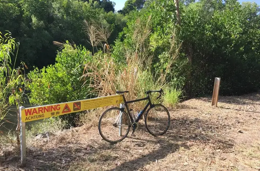
Out for a morning ride. Gravel path looks fine even for skinny tyres.
Croc warning not a problem, I wasn't planning a swim in the mangrove swamp.
What it didn't explain was that that the mangroves are on both sides of the path. Usually it's a good idea to keep 6 metres away from the edges. Path was 4 metres wide at most...
Survived - crocs had probably already eaten breakfast...
Attachments
- Feedback
- View
Re: Re:
Have I?
I'm gonna guess it's made of wood and canvas. Am I close?
Jamiedyer":3ofcqifp said:Well I left work yesterday and headed south to pick up a project that has been waiting for me for a while, it doesn’t need much just now and is very usable as is. Very excited as I have been looking for one for ages since the first time I seen one in Canada and this is perfect.
It’s not cycling related but is definitely retro. Barry definitely would understand and has seen this
Have I?
I'm gonna guess it's made of wood and canvas. Am I close?
Re: Re:
:shock:firedfromthecircus":zz27ly8r said:I'm gonna guess it's made of wood and canvas. Am I close?
epicyclo
Senior Retro Guru
Re: Re:
Oh goodie, a Tiger Moth?
firedfromthecircus":3ughj03y said:I'm gonna guess it's made of wood and canvas. Am I close?
Oh goodie, a Tiger Moth?
old_coyote_pedaller
MacRetro Rider
- Feedback
- View
Re: Re:
Ah, is it a wood strip canvas canoe Jamie?
firedfromthecircus":26ytjmw9 said:Jamiedyer":26ytjmw9 said:Well I left work yesterday and headed south to pick up a project that has been waiting for me for a while, it doesn’t need much just now and is very usable as is. Very excited as I have been looking for one for ages since the first time I seen one in Canada and this is perfect.
It’s not cycling related but is definitely retro. Barry definitely would understand and has seen this
Have I?
I'm gonna guess it's made of wood and canvas. Am I close?
Ah, is it a wood strip canvas canoe Jamie?
Re:
It is indeed a wood and canvas Old Town HW.
I am currently sitting in a services just shy of the border, so will soon be safe and back with my own kind
Well pleased with the canoe as had seen its history on SotP forum previously and when it came for sale we did a deal that was great for us and helped in no small part that it was going to a family that would use it and also that I can maintain it as it should be. The history and everything checked out with Heritage Canoe Association and so here we are ready to paddle
We will keep our other Old Town Guide and this will be our Sunday best type canoe. So my kayak that rarely gets used as I am a canoe boy myself will be up for sale if anyone wants a cheap kayak, just message me.
Jamie
What is yours Jamie, canoe or kayak ?. I now remember the one in the hall was a 2 seater with a longer cockpit, but not completely open stem to stern :? I think the early ones with a front deck were still classed as a canoe because of this longer cockpit.
So when are we getting pics then. After you've spent the evening sitting in it in your livingroom

So when are we getting pics then. After you've spent the evening sitting in it in your livingroom
Similar threads
- Replies
- 6
- Views
- 674
- Replies
- 0
- Views
- 641

