Lackluster
rBotM Winner
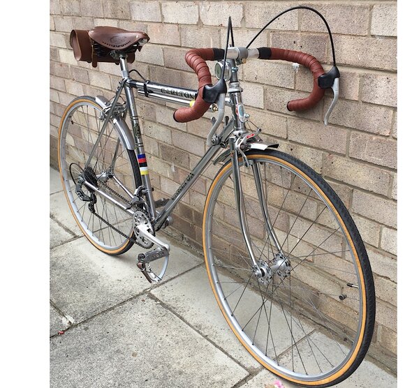
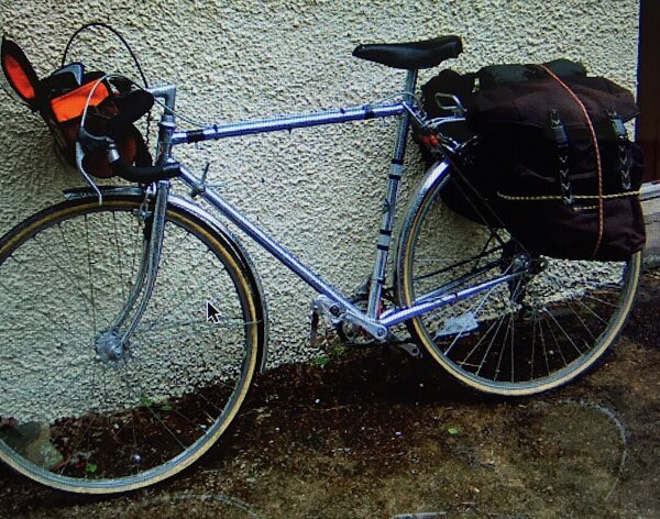
An account of my trip with the 1974 Carlton Cobra in 2005
A Lakeland Loop (RB)
(Rough Stuff Fellowship)
Day 1: Ulverston to Elterwater - 19 miles
My celebratory ride was to start on the Whit weekend exactly 50 years after the clubs formation at Leominster. It would take in some of the favourite tracks described in old journal articles by Bill and Nellie Hill, Arthur and John Matthews, Bob Harrison and Albert Winstanley, all members who passionately love and loved the Lake District.
The ride was to start at Ulverston, described by writers of the Cumbria Way as the gateway to the Lakes. The circular route would take in some of the remote high moorland passes as well as the picturesque valleys so loved by Lakeland poets and artists, and so it was that five members from Lancashire met at Bryan's home in Ulverston for the start of our adventure.
The group consisting of four touring cycles and two mountain bikes left Ulverston on a clear bright sunny day taking a route of quiet back lanes which gave us superb views with Morecambe Bay behind us and the Lakeland Fells ahead. On reaching Lowick Bridge we made a turn to follow the River Crake in the direction of High Nibthwaite and on reaching the phone box in the village turned for the start of the our first rough stuff track of the trip. (SD295897)
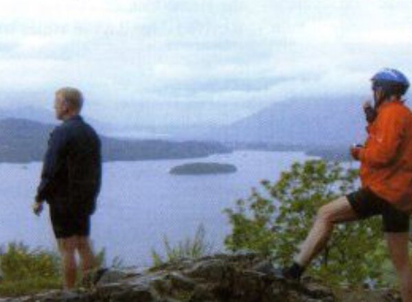
After a hard pull up for 3/4 of a mile on the stony track, we stopped on a sunlit grassy bank for lunch. After a leisurely lunch we continued with the long pull up to Parkamoor where the vista opened up to give us a superb view of the whole of Coniston Water with Coniston Old Man standing majestically in the background. The ideal conditions brought out the cameras in abundance. From Parkamoor we dropped down through the grounds of the ruined house at Low Parkamoor, the front garden of which forms part of the bridleway which leads onto a sometimes grassy, sometimes stony track over The Park, and on down into Heald Brow Pasture in Grizedale Forest.
On meeting the wide forest fire road we took a left at (SD3l8943) to head towards our next destination of How Head a quiet backwater on the northeast end of Coniston Water. From here a difficult pull up on tarmac tested our fitness levels, which would again be tested to the limits over the next few days. To avoid the popular area around Tam Hows on a Bank Holiday Monday we made for the village of Knipe Fold, which meant we took the first road left after passing the quarry on the main Coniston to Hawkshead road.
It was in the village of Knipe Fold that we found a lovely tearoom, which appeared at just the right time. We all sat under the pagoda shaded from the sun, admiring an unusual but magnificent handkerchief tree, which stood in all its glory in the well-kept garden. After the much needed refreshment stop we continued on a B.O.A.T to the west of the village at (SD342995). This B.O.A.T. took us around the north end of the tams and after travelling a couple of mile we then turned right through a gate which led us into a plantation.
The last time I had been this way (two years previous) the path had been lined with tall conifer trees. This time the area looked as if a nuclear bomb had hit it, all the trees were flattened to the ground, testimony to the high winds the area had received in the January gales. (It was a sad site to see). This bridleway eventually led us steeply down to the road where we turned left, then immediately right to follow the road down over the river into the picturesque village of Elterwater and on to our overnight stop at the youth hostel.
Day 2: Elterwater - Derwentwater
The second day of our celebratory ride dawned bright and sunny. Peter G and Bryan had stayed at the Langdale YHA a few miles up Red Bank at High Close.
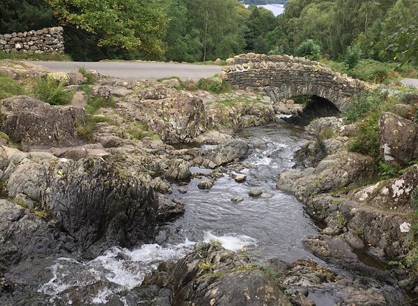
They arrived promptly at 9:45am and after a hearty hostel breakfast we were all ready for what was to be one of the toughest days of the tour. It was at this point that Peter G thought that he had left his mobile phone on his bunk at the hostel, and decided to ride the hill back to the hostel. He did however arrive back within a couple of minutes having discovered that it had dropped down in his pannier fortunately before he started up the hill, which was just as well as the days ride started will a hill climb back up the road we had come down the previous day. This climb was only for a few hundred yards before we branched right onto a No Through Road (NY325044) which eventually led us to our first track of the day, avoiding the heavy traffic in the Langdale valley below. After a bit of to-ing and fro-ing at a farm on route courtesy of my map reading, we finally made the bridge, which took us over Great Langdale Beck, an ideal spot for some photos.
From here we made for the main road to take a left then almost immediately another left onto a byway rideable all the way to the New Dungeon Gill Hotel where we stopped for morning coffee. This would be the only hostelry available for sustenance until we made Stonethwaite in the Borrowdale valley.
After refreshment we took the stony track behind the Hotel heading west towards the Old Dungeon Gill pub where we would join the wider track along Mickleden. This track was rideable in parts but the nearer you got to the head of the valley the more boulders obstructed our way. This was to be a taste of things to come as we lifted, dragged and rolled the bikes along to were the track divides between Esk Hause going west towards Rossett Gill, Rossett Pike, Angle Tarn and Stake Pass going North leading to Langstrath Beck and eventually Borrowdale.
Stake Pass was to be our way and the ascent certainly looked daunting from the bottom of the pass looking up towards the saddle gap up on the horizon. After a short stop to gather our strength we made our assault on the pass. A few walkers stopped to ask why we were taking bikes over what was a difficult walkers path. We gave them the usual answers that we were on a day release from the local asylum. Seriously though Ken G was taken aback when a young lady waylaid him on the way up to ask "What was a laryngectomy doing struggling with a bike over this terrain?" It turned out that she was an ENT nurse and that she and two friends from the NHS had stayed in the YHA with us the previous night. It shows how tired we must have been as none of us had noticed them.
After a lengthy conversation with Ken it was a surprise to me that they did not offer to carry Ken's bike and saddlebag to the top. We did however pass them lying flat out, totally worn out, asleep on the top of the pass. Finally we all conquered the pass and after lunching on top of the world, made our way down on a grassy, I in 4 sometimes rocky track into the valley below, following the right hand side of Langstrath Beck into Stonethwaite where the pub gave us time to recover from 6hrs of mainly pushing and carrying the bikes. From here my plan had been to take the bridle way up to Watendlath from Rosthwaite, but on reflection, and risk of mutiny, I made the decision that it could wait until tomorrow. From Stonethwaite we made our way by road to the YHA hostel on the banks of Derwentwater. Two of the group however still had the energy to head into Keswick for a drink after our evening meal, the remaining four chilled out with hot drinks, showers and a good read before turning in for the night.
Day 3: Derwentwater- Patterdale
The Wednesday morning of our Lakeland ride dawned drizzly and dank. It was going to be waterproofs from the start of the day, a stark contrast from the previous two days of glorious sunshine. I had decided the previous evening to start the day with the bridleway from Watendlath to Hazel Bank Rosthwaite, this started with a long climb on the road from the hostel to Ashness Bridge.
This was a tough start, especially for those who had the full English breakfast in the hostel. The bridge, despite being a popular visitor attraction and the most photographed bridge in the Lake District was deserted on this wet morning, as was surprise view a little further up the road, a great vantage point giving lovely views of Lake Derwentwater, Catbells and Black Crag opposite. We did not linger when we reached the village of Watendlath but took the track leading west to Rosthwaite this track proved to be rocky and stony and was also very slippery in the wet conditions. Eventually we reached the road, turned right and on to Grange for a morning coffee stop.
From Grange we rode to Manesty and joined the bridleway below Catbells, passing Hugh Walpole's seat on the way. This bridleway is a stony pull up to start with, but eventually becomes a grassy ride parallel to the road, avoiding the traffic on the west shore of the lake, but giving superb views of the lake and the fells to the east from its elevated position.
Eventually we dropped back to the road, and on through Portinscale to Keswick. Here we stopped for lunch and to stock up with provisions for those members who were cooking for themselves at the next hostel. It was a great shock to suddenly experience the traffic and the crowds in Keswick, especially having seen only half a dozen people on our trip over the previous few days.
We left Keswick using the disused railway track from behind the swimming pool; this track has now been made into a good cycleway crossing streams on old railway bridges. The track covers about 6 mile and led us to Threkeld now completely cut off from traffic, bypassed by the main road running from Keswick to Penrith. We crossed the road at this point and made our way down the valley to St Johns in the Vale.
From here we took a left onto the Old Dockray Coach Road. As suggested by the name it was a road across the fells used in previous centuries to travel from Keswick to Ullswater. The track has now become difficult as it climbs steeply from St John's in the Vale on a loose bouldery surface made worse by the access and use of four wheel drive vehicles. Indeed one passed us dislodging more rocks as it bounced its way down the track.
Upon reaching the highest point the track becomes grassy and stony, but we were able to ride the remaining miles over a remote and desolate moorland landscape in very wet conditions on to Dockray. On joining the lane at Dockray we dropped steeply for about 3miles down to Lake Ullswater. The need for good brakes being essential, especially as the lane meets the main road from Glenridding to Pooley Bridge at a T-junction.
After a short stop for refreshment we made our way to the Patterdale hostel, which was to be our refuge for the night...
Day 4: Patterdale to Ulverston - 43 miles
I woke early on the final day of our Lakeland loop, and as I sat gazing from the hostel window at the low cloud base that hung over High Street, I realised that the route planned for the day over High Street to Troutbeck would have to be changed. This decision was confirmed when we arrived at Hartsop, which would have been our turning point for the fells, by this time not only was the cloud base low but it was raining heavily, and as we caped up at the bus shelter we decided that the road route over the Kirkstone Pass was our only option.
The long drag up the pass was made more difficult with the rain and wind, and as we struggled it was nice to receive shouts of encouragement and hoots on horns of vehicles going in the opposite direction. Eventually we reached the summit of the pass, and decided to take the long steep downhill road into Ambleside. It was on this road that a motorist decided that I had no right to be on the road, and as I was traveling at about 20mph (wet conditions), he drove inches away from my rear wheel and eventually decided to overtake on a blind bend, causing me to brake hard, they say riding the fells is dangerous, at least on the fells we are not at the mercy of other peoples inconsiderate actions.
Ambleside was even busier than Keswick had been on the previous day. It took a while to get a place in a café for coffee, as it turned out the chap who gave us his seat was the warden from the Elterwater hostel, we had stayed there on our first night.
From Ambleside we took the road to Hawkshead for lunch, and after shopping for shoes for Ken, we made our way towards Coniston, turning to take the road on the east side on the lake below the High Nibthwaite track we had taken on our first day. From here Bryan led us down the quiet lanes back to Ulverston. I must say a special thank you to Bryan's wife who put on a lovely tea with huge pieces of homemade ginger cake. It is no wonder Bryan rides as well as he does over the high fells.
GENERAL COMMENTS about the trip:-
The trip was conceived after reading articles in past journals by Bill and Nellie Hill (Nellie's Hills). Arthur Matthews (Gateways to Paradise), and other trips made by Lancashire members Bob Harrison, Gerry Swift, John Matthews and Albert Winstanley.
Starting the trip on the date of the 50th Anniversary seemed very appropriate and I would like to thank my companions Ken G,Peter G, Peter K, Brian P and Bryan L, for their company on the trip.
From a personal point of view:
I took too much. In future (Travel Light)
For Peter G (He had a tough initiation into rough stuff)
I greatly admired Ken's tenacity and strength on the trip.
We all know who now holds the TM trophy for snoring.
The total distance covered was 100 miles door to door.
Attachments
-
 650C35E1-30AD-40F3-9A96-CE353478BFB1.jpeg67.5 KB · Views: 518
 -
 D8C2E9C1-426A-4FA1-90C6-85378C0F3D93.jpeg276.8 KB · Views: 517
 -
 3C63469B-A22F-461F-B40C-82E9DF201B4F.jpeg65.4 KB · Views: 516
 -
 9ECFD176-617D-4090-B8BB-1F1A50DBE96C.jpeg64 KB · Views: 515
 -
 F44C7CF5-90B3-46C6-A827-E27A4E7C4620.jpeg65.9 KB · Views: 517
